The Capital Divide

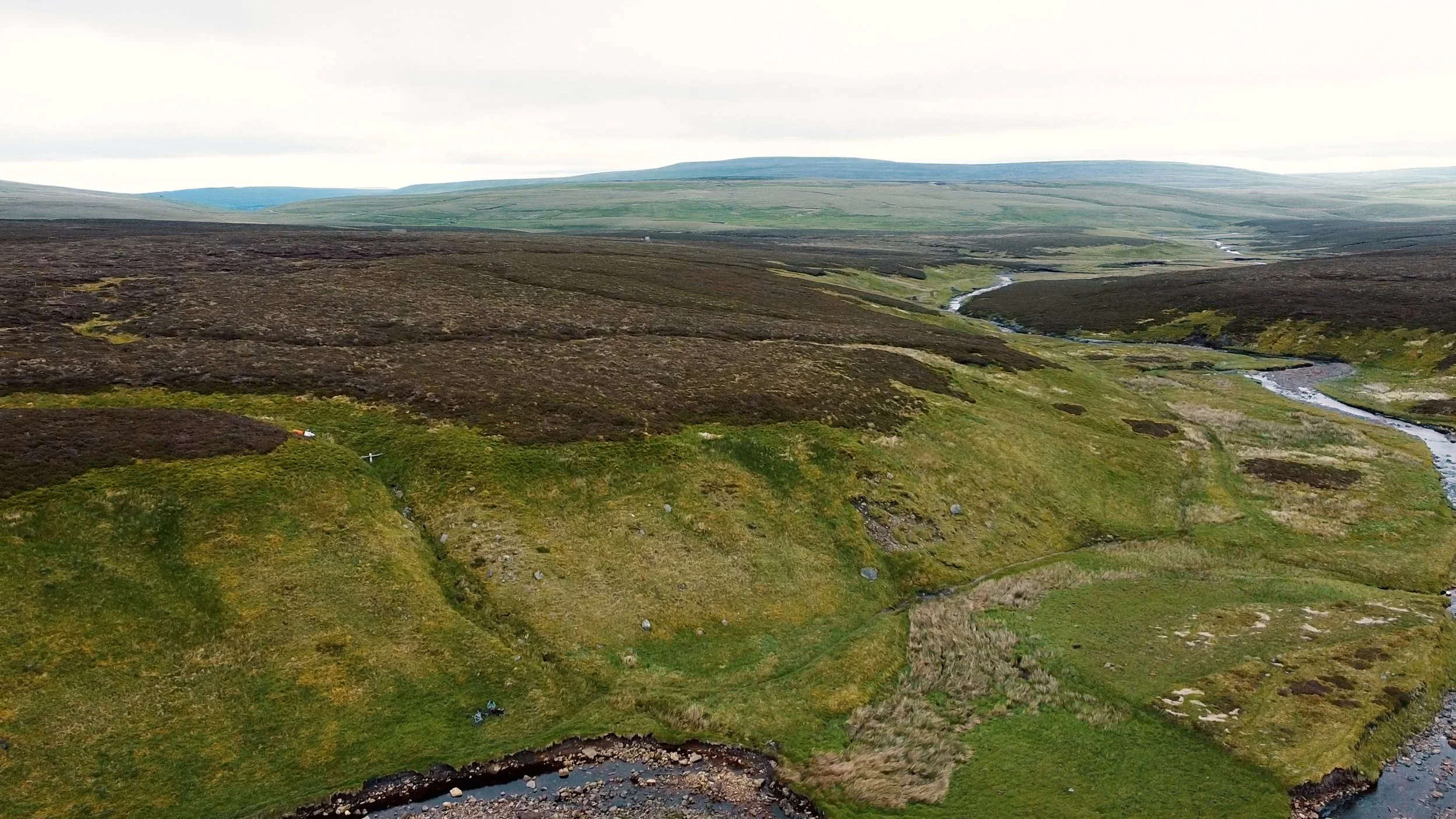
Climb up to scar house, Yorkshire.
This is the capital divide, a route I have been working on putting together for a couple of years now, linking up Edinburgh to London to Cardiff using some of my favourite trails over the last couple of years since I started Keep Smiling Adventures. The future idea though is to continue this route over to wales to Cardiff then through wales up to Belfast via Dublin just for good measure.
Check out the videos PART ONE & PART TWO
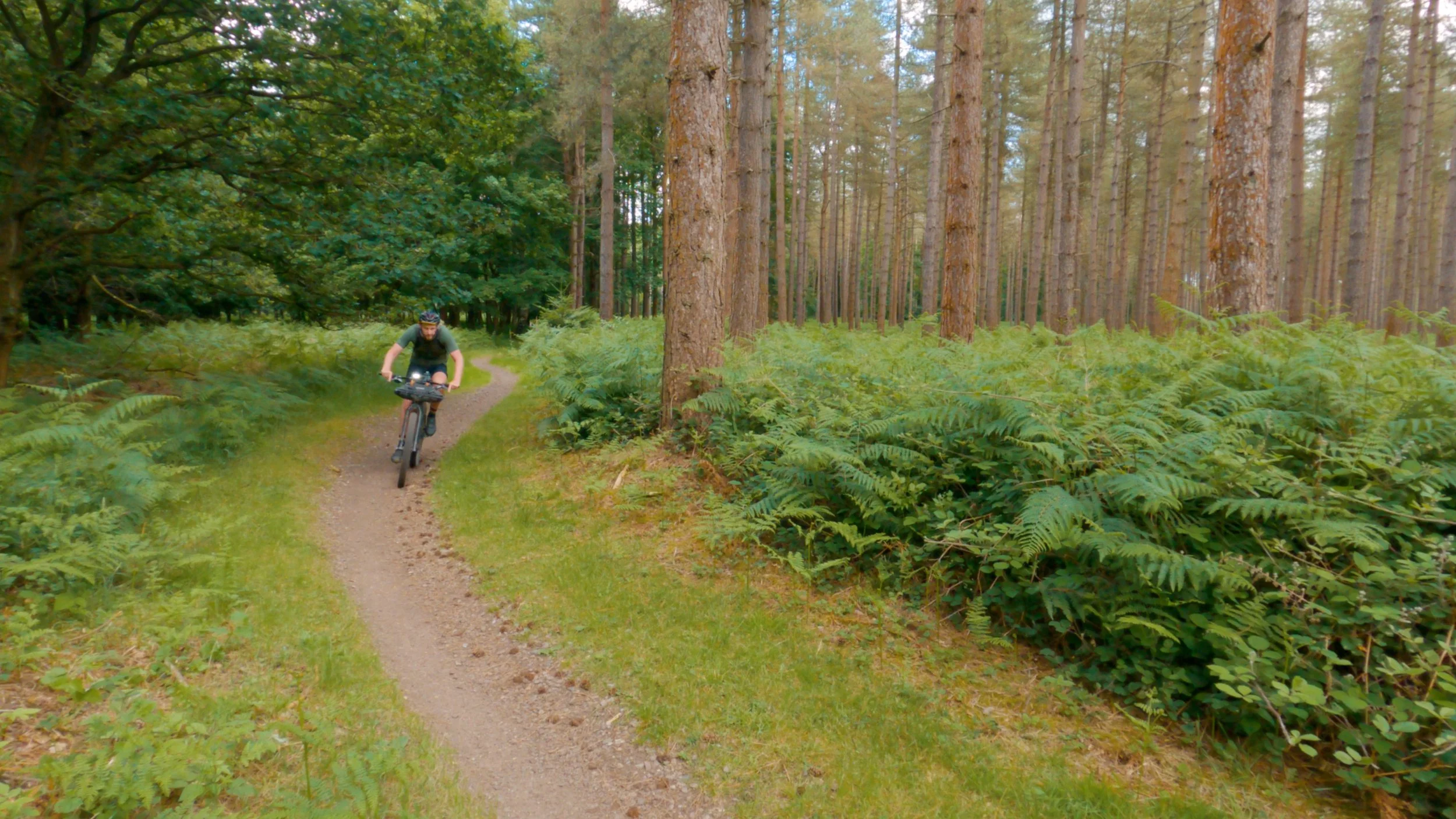
This Route covers over 600 miles, 1000km. It is a story of two halves though, with the first 300 miles being where all the climbing takes place and the final 300 miles is where all the pedalling takes place as you head into the ever flat section of England, over to the East coast. So it is definitely best to take this route on from north so south, so the adventure gets easier as your legs get more and more tired. Although when I was putting this route together I wanted it to feel like you were making progress, as much as possible. So many of the routes I have taken on over the last couple of years on the channel, the one thing I have found is that they can drag so much. Zigzagging all over the place to hit every off-road trail that you can possibly find, often just to come back a mile or two from where you just were. While being off-road is great, it often completely ends up becoming boring and tedious in my experience. So when putting this route together I wanted it to keep moving, there are still some slow-going sections, but you will always be rewarded with some easy pedalling. I wanted it to be real gravel bike friendly, so lots of forest tracks and less technical trails. (There are still some rough stuff, but it’s mostly pretty short) So although this route will see you head through the Pentland Hills, Northumberland, The North Pennines, The Yorkshire Dales and the Lincolnshire wolds I have used the trails that are fun to ride and not overly hard and easy to follow. As best, I could. There are road sections of this route, but they are all pretty quiet, or have a cycle path to use.

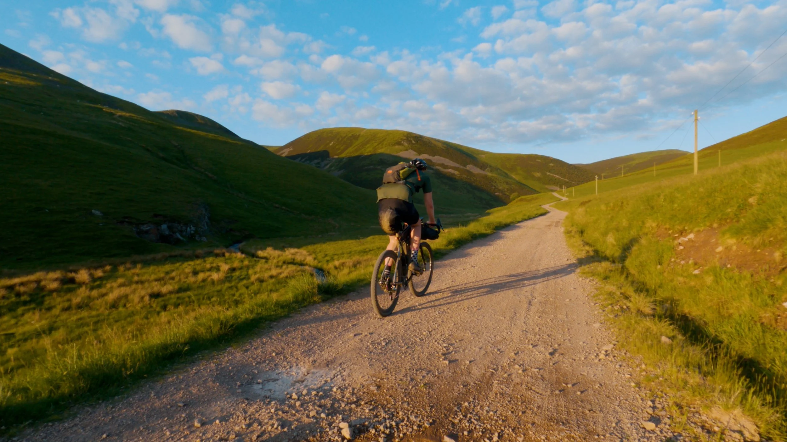
Pentland Hills
Starting in Edinburgh, you will be leaving the capital of Scotland along the canal, and you will soon be in the Pentland hills, where you will have some incredible views in all directions as you climb the gravel tracks to the top. The track isn’t anything too technical, but you will want some nice easy gears as you head up to the top. If you start in the evening from Edinburgh, then this is a good place to camp for the night up here. After getting to the top though, you will be able to look back and enjoy them epic views before take the easy way down, a nice long gravel road. The Pentalnd hills is pretty short but incredibly beautiful.

Gravel gravel gravel
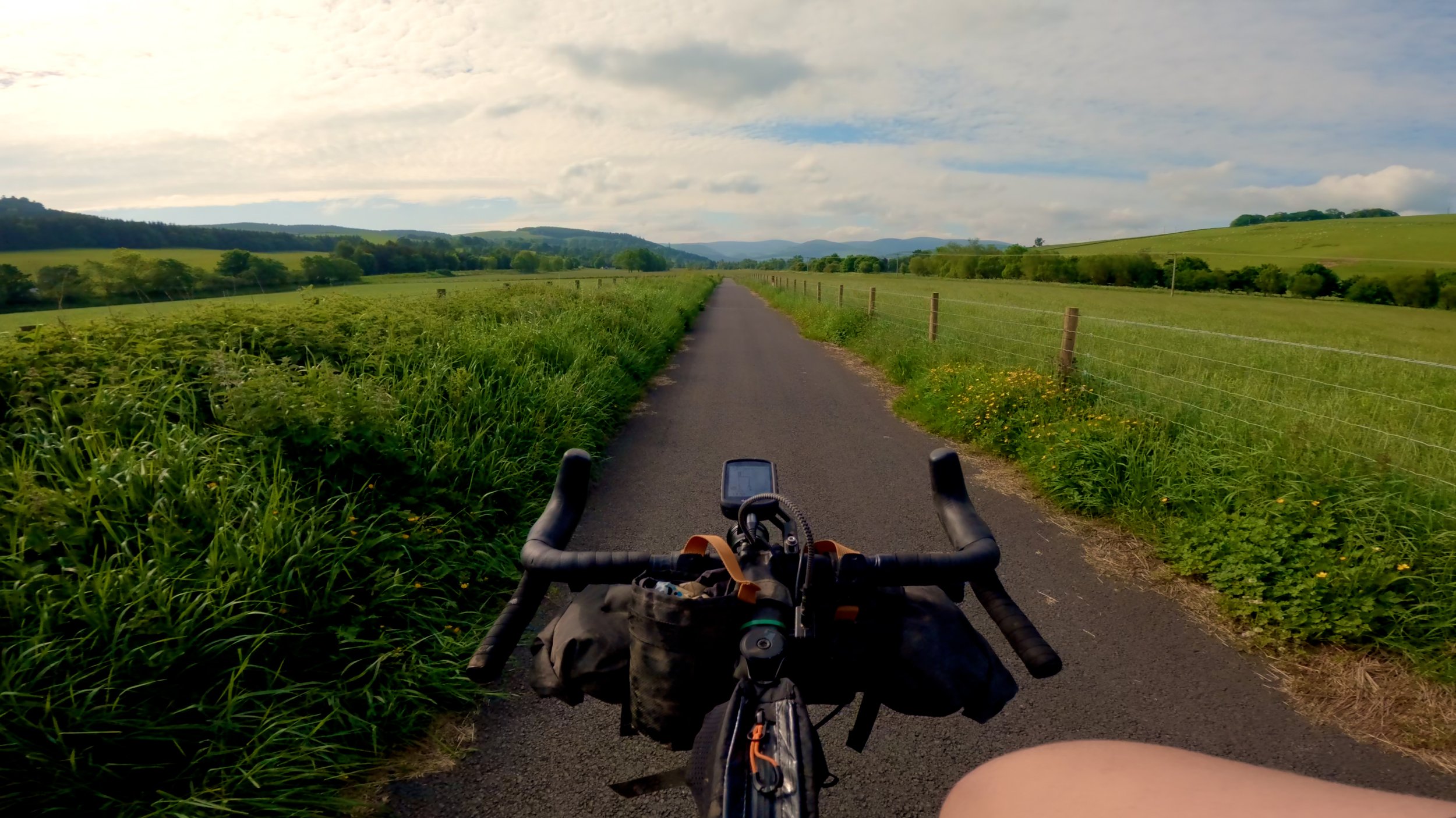
After leaving the Pentland hills you will head to the little town of Peebles, a good spot to collect some supplies and hopefully not need the bike shop like I did so early on, but there are a couple here which is good to know. Leaving Peebles is along a nice cycle track following the river Tweed for a few miles, you are following the direction of the river so it is ever so slightly down hill in this direction which is nice. And you should use this time to warm up the legs before getting onto some long gravel climbs just past Innerleithen. These are perfect for the gravel bike, you might see the odd uplift van pass you as the mountain bikers head to the trails, it was tempting to ask for a lift as I cycled up the long windy gravel tracks, but you get some awesome views and of course with the endless peddling up hill you do get them endless descents. To get from Edinburgh to the boarder crossing is actually only around the 100-mile mark, so depending on what time you start you will likely be there within 1–2 days, but I recommend trying to at least get one night on the Scottish side for a camp. There are some great places actually on the border as you cross into Northumberland.


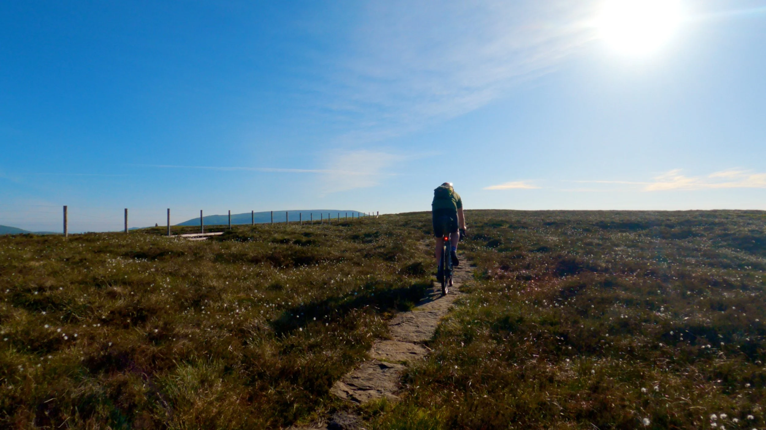
Before you get to the boarder, you will follow a Roman road called dare street which can be tiring but nothing compared to the actual crossing into Northumberland which I think it probably the hardest part of the route, The first part is really nice as you gradually climb up along some nice gravel farm tracks, but then you have to get up a pretty steep track, I’m not sure if I would ever have the energy to pedal up it but its probably doable it’s not really technical. Just steep, The track is easy to follow, but it does turn into grassy double track as you can see from the above picture, which makes things a little harder and slower. The is easily the most beautiful part of the route though, especially if you get up here as the sun is rising, ooh will you be in for a treat. At least if the sun is shining, if not, then this section will feel pretty hard work for not much reward. There is no big sig welcoming you back to England or Scotland saying goodbye this way, just a gate explaining that there are different rules in the two countries so you know you are crossing the boarder. You do briefly return to the Scottish side once more to get to the trig point before crossing back into England and where you will start your adventure into the rugged and beautiful Northumberland along some pretty handy well-placed rocks. These stones make it ridable instead of bog, which is what undoubtedly why these stones have been placed here. They are ridable, but it is a little awkward on the gravel bike, and you need to keep an eye out because there are little stone bridged that can get lots in the vegetation each side, and you don’t want to be crashing here, so ride these with caution.

Scotland is the other side of that fence

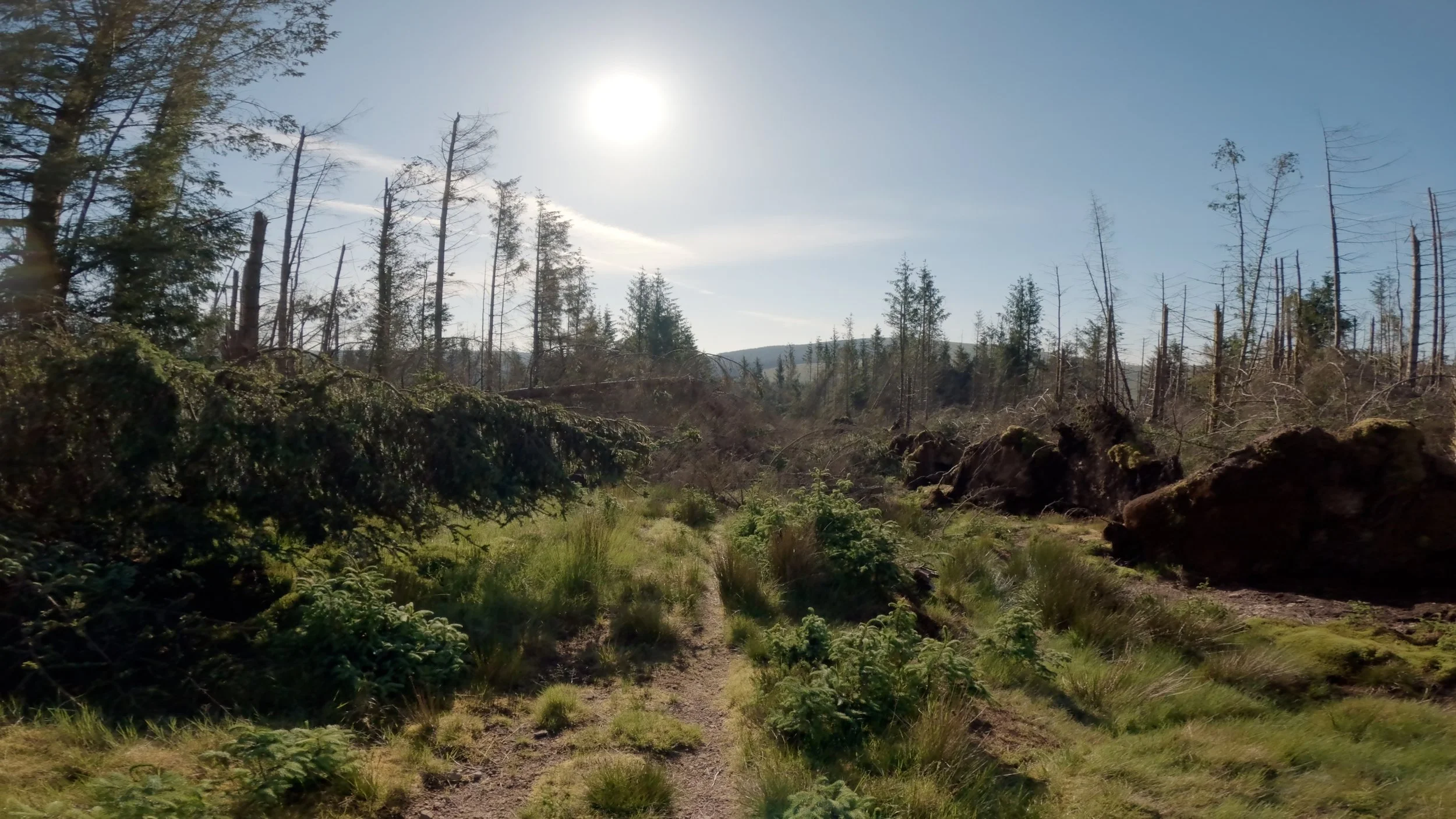
Detour
Unfortunately, there is a slight detour in the route currently, as a storm has made one of the trails impassable with fallen trees. There were signs up on the other side saying that it is being worked on, so hopefully it will be passable once more soon. The detour come not long after you cross the boarder and as you can see you are meant to go where Pin 60 is and cut through. Instead, the detour takes you around. If I’m honest it doesn’t kind of ruin the flow a bit as you have to go down quite a steep technical descent (it is quite short, but I walked it) To then climb back to the trail. Hopefully if you decide to take on this route then the trail is passable again I will leave the route like this so you know where to go. Just cut through instead of going around if you can.

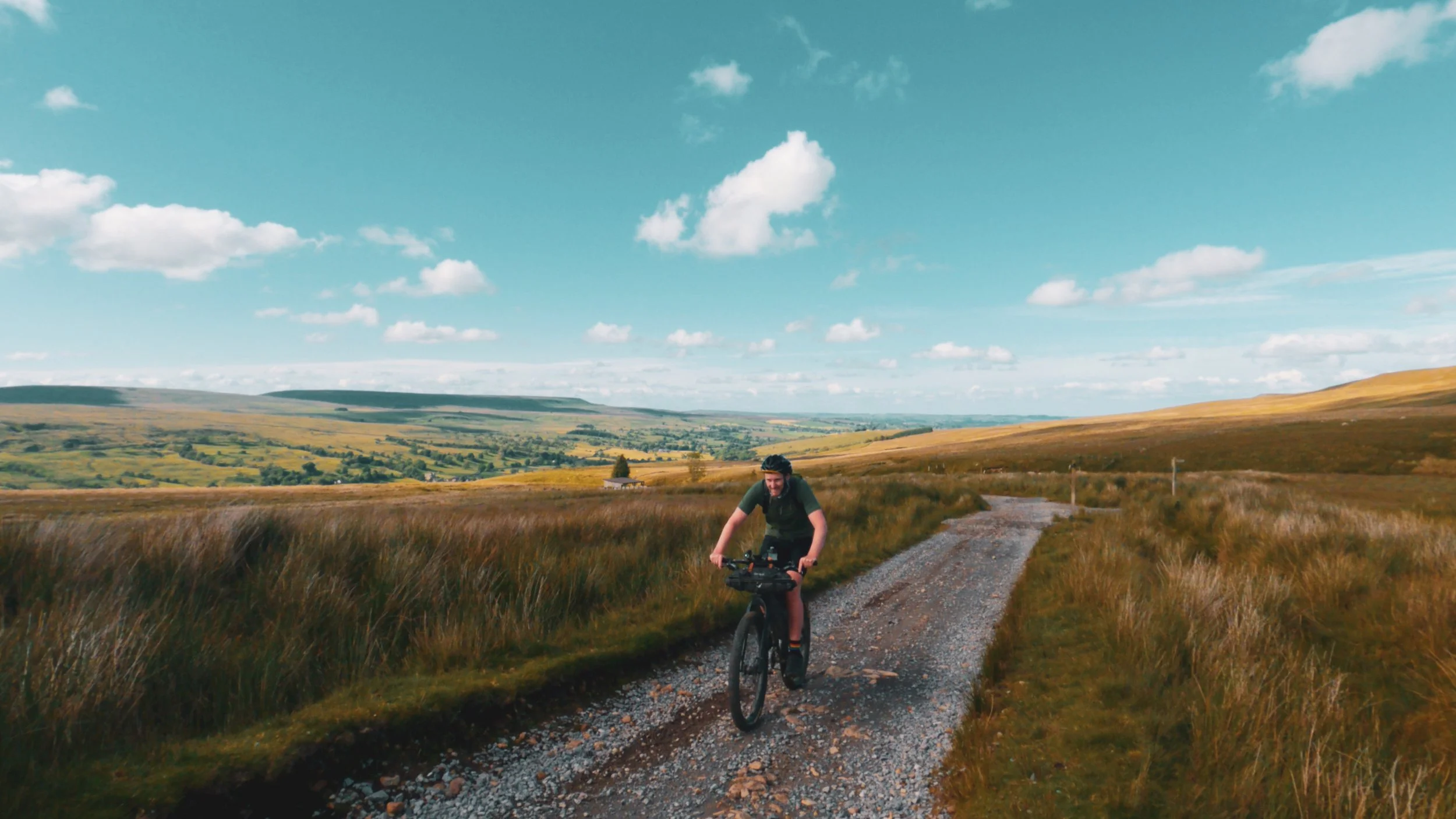
Northumberland is probably the hardest section on the route, but oh is it incredible, the trails are steep, and the trails are not as smooth as the forest tracks you were treated to in Scotland and can feel a bit rough on the gravel bike at time so make sure you are running the bigger end of the gravel tyres 45-50mm is your best bet for this adventure. But like is said when putting this route together, I always wanted the harder parts to be followed by some easier miles. And the next miles as you head towards Otterburn are all paved as you head through all the military training areas, don’t go off course around here, stick to the roads. They are quiet any way, with lots of long fast descents. Admittedly, this could actually be a pretty hard place to ride if the weather was not in your favour as it is incredibly exposed, but it’s paved at least.
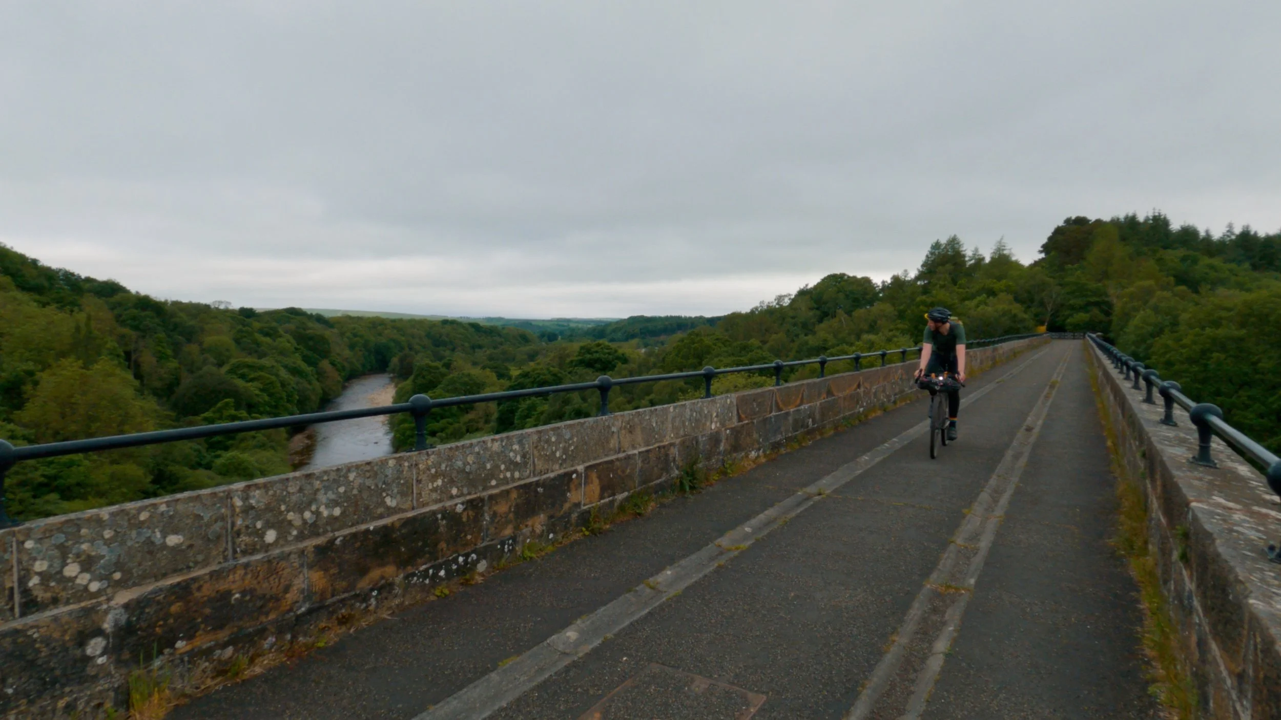
Your next stop is Haltwhistle, but not before lots of gravel tracks to get you there. Make sure you use Haltwhistle as a refuelling station because once you leave Haltwhistle you will have a pretty long slog up to Great Dun fell. But not before you're riding along the old railway line and across Lambley viaduct. Not that there are steps that you will need to push your bike down and up after the viaduct. If you don’t want to do that then you will need to follow the national cycle route which goes around the viaduct.


I wanted to avoid as much hike a bike as possible but when it comes to the great dun fell climb it’s either go a different way that it is ridable up, but the descent is meh at best to hike up through moor house and get the epic road descent. Going from north to south, I don’t really mind this hike a bike too much, as you do get a really great ridable descent at the end. The other way though feels really disappointing as you climb and then walk the descent. The climb up through Moore house to great dun fell can be a bit hard to follow and wet and boggy in places as you just follow a river up to the top. The hike a bike is not that steep, it feels quite flat actually for the most part. But the sure footing is needed because the river has worn away a lot of the main path. Some parts are ridable, but not much. The hike to a bike is probably about 3 miles, so it will probably take about 1 hour to get to the top. Then you will understand how fun the descent is as it is paved, but it’s just an access road to the observatory so you are unlikely to see any cars on this road, and you can really fly down here. And then enjoy a long descent all the way to Appleby. This is also the highest point on the ride at just under 2400ft.


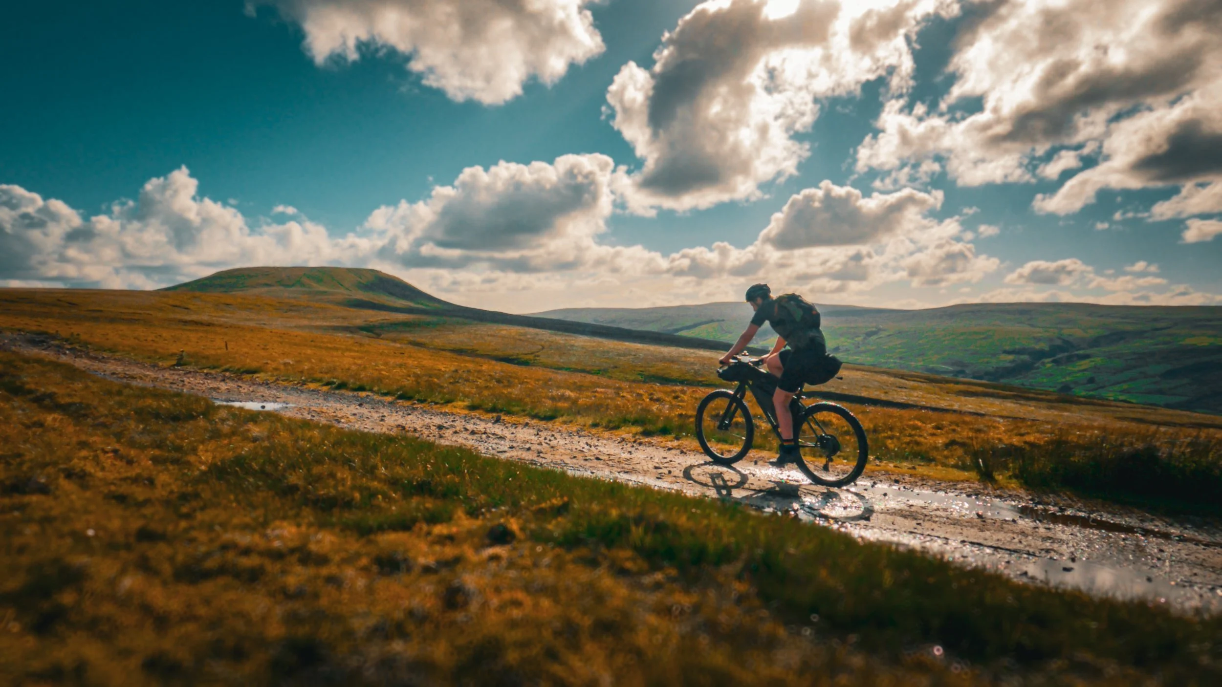
Once in Appleby, it’s on to one of my favourite parts of the county, the Yorkshire Dales. It’s a nice gradual ride towards Kirkby Stephen as you just pedal along the quiet country lanes. Before heading off-road with great views of the river Eden down below. These trails are typical of the Yorkshire dales, a little on the rough side for the gravel bike, but totally manageable if you have the legs for the steeper sections. I ended up camping looking down the valley where the river Eden lays and the view was incredible. Not so much when I woke up, though. Like so much of this adventure, you are in remote places and the weather can often change, and fast. And that’s true with the next trail you will take on, a great, challenging old Roman road from Bainbridge. It often looks a lot easier than it is, but make no mistake even though it looks flat with some steps in the distance it is not and can feel like hard work on the gravel bike as the smaller tyres of the gravel bike struggle not gain traction on the loose rocky trail. You might be lucky and get a tail win up here which would help no ends, but I have yet to have that luck, and it is normally a pretty furious headwind that gets hard and harder the higher you get. If the weather is clear and sunny though, you will have some great views over the Yorkshire dales.

Roman Road from Bainbridge
Once getting to the top of the old Roman road, you are rewarded with a very fast road descent that flows down a valet towards Kettlewell before heading up on a couple more challenging climbs. Getting to Kettlewell, you can rest assured you are nearly over all the hard hilly terrain and are nearly into the second half of this adventure. And once you climb up the final climb and see scar house reservoir, you know it, you have done the hard part of this adventure. Everything else will feel flat. Kind of.

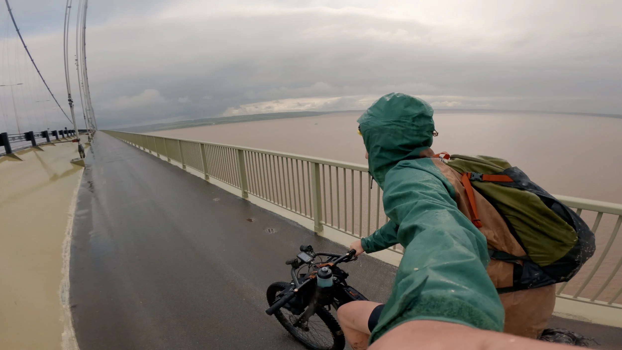
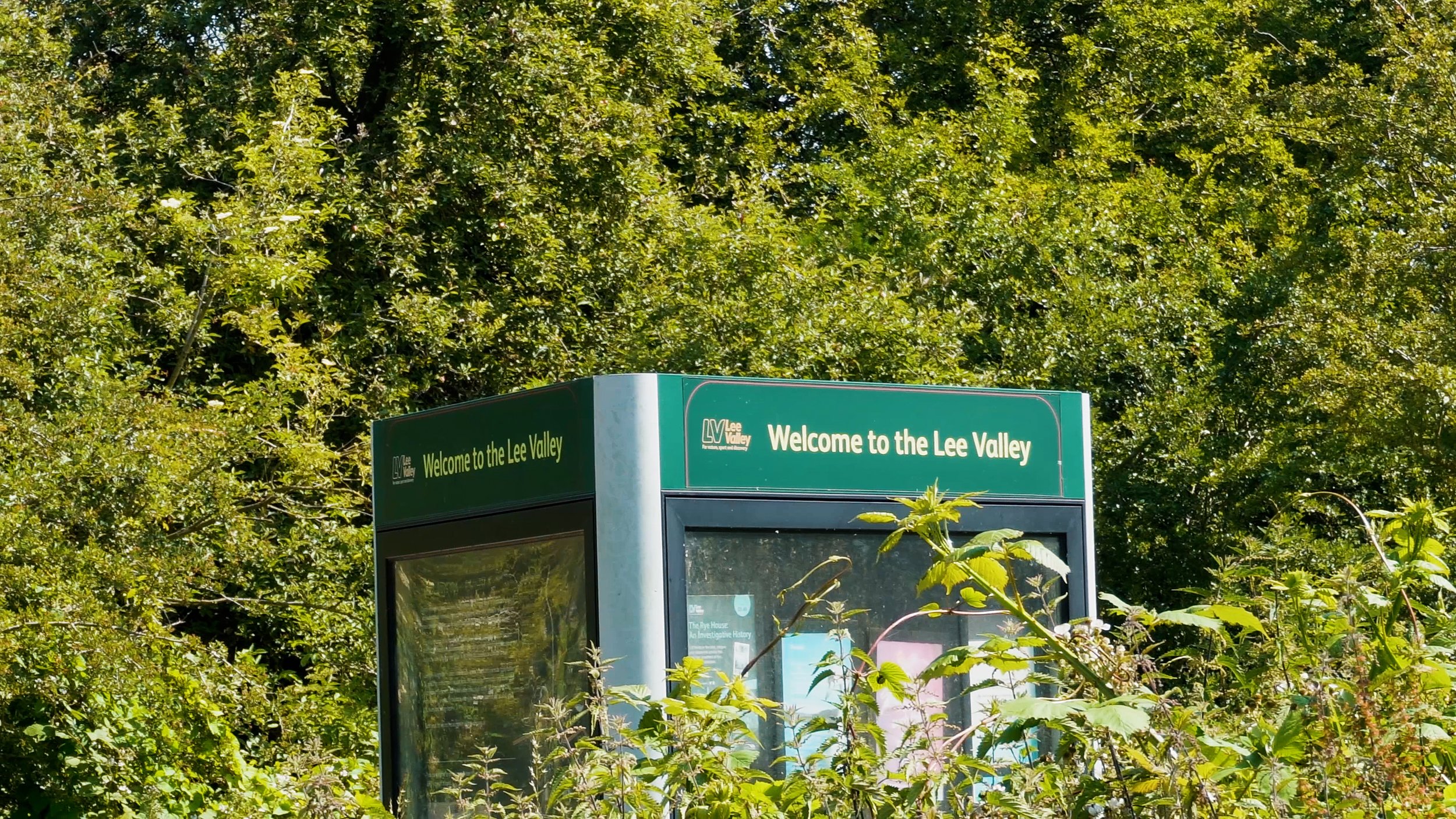
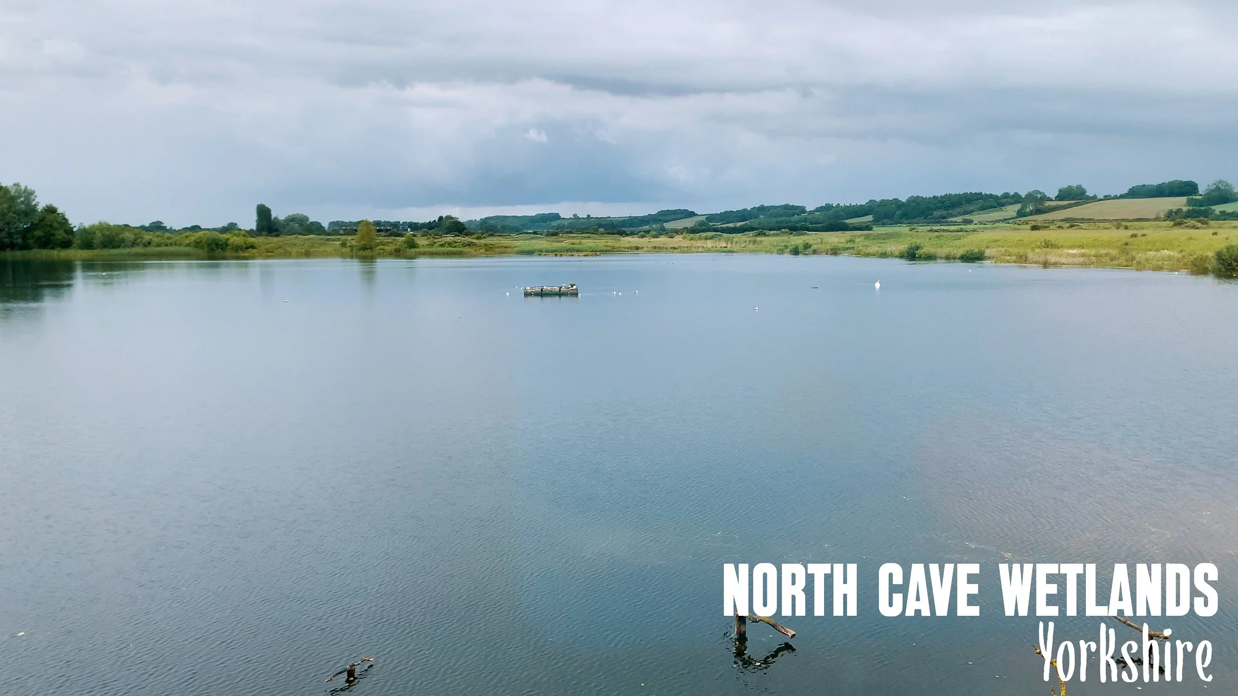
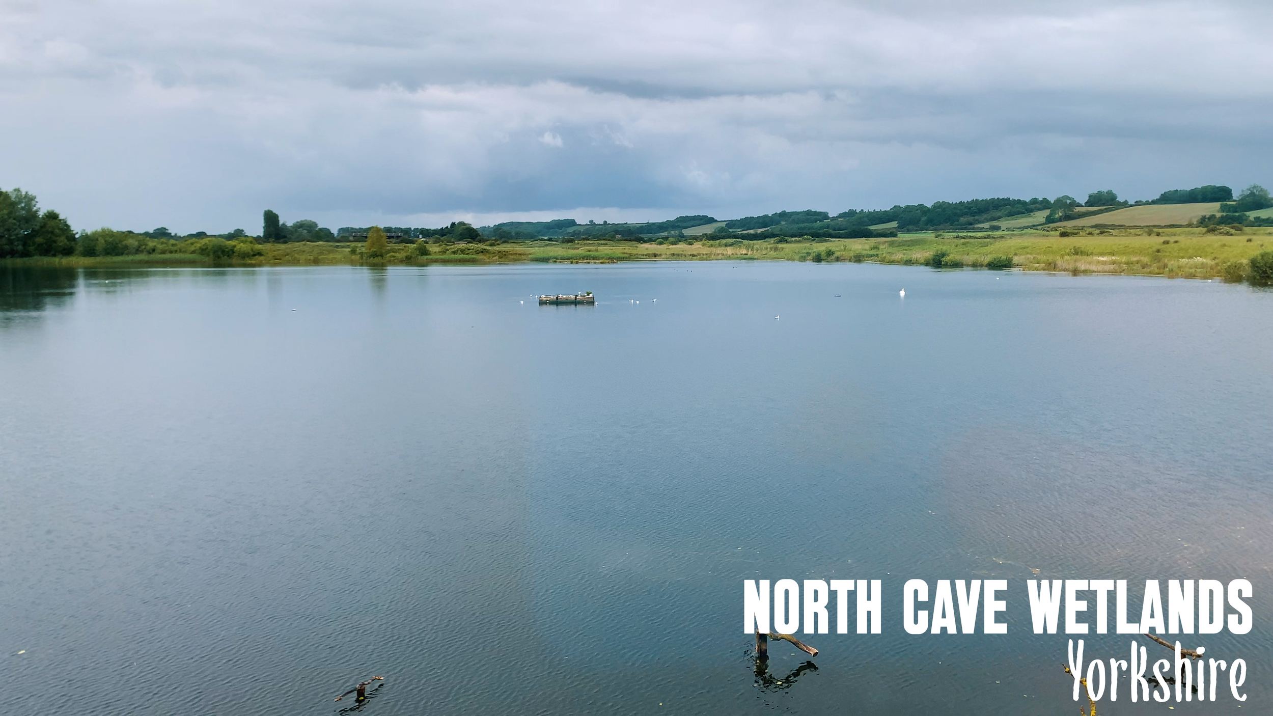
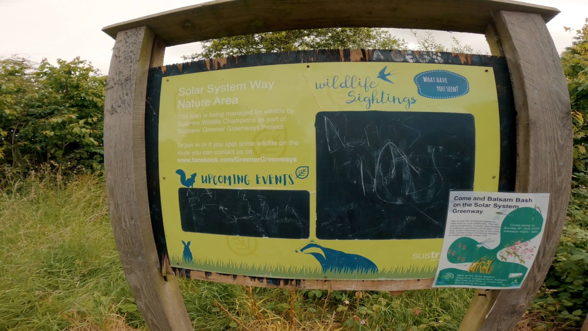
The second half of this adventure is a lot more tame and easier going, with very little in the way of climbing. And after leavening the Yorkshire Dales, you will have a day or two of easy pedalling as you head in the direction of the Humber bridge. After a quick visit to the beautiful city of york, you will head a long a fascinating cycle path (shared use but traffic free) if you like space anyway it’s called the Solar system way and has lots of interesting things to stop and look at. As you make your way through the solar system, and who knew, the solar system was also really flat. After that flat cycle path you will head to another flat trail called the Rail trail another old railway line that is not as well maintained as lots of other similar trails, but this makes is essentially one long single track trail. A quick stop off at north cave wetlands where you can take a seat in the bird hide and watch the nature doing its thing or more than likely just a welcome break from the rain. Before heading over to the Humber bridge, where you will leave Yorkshire and enter Lincolnshire as you head to the Lincolnshire wolds.


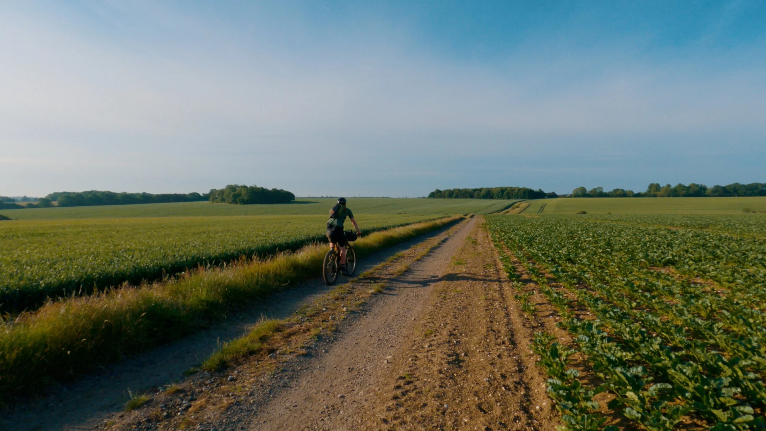
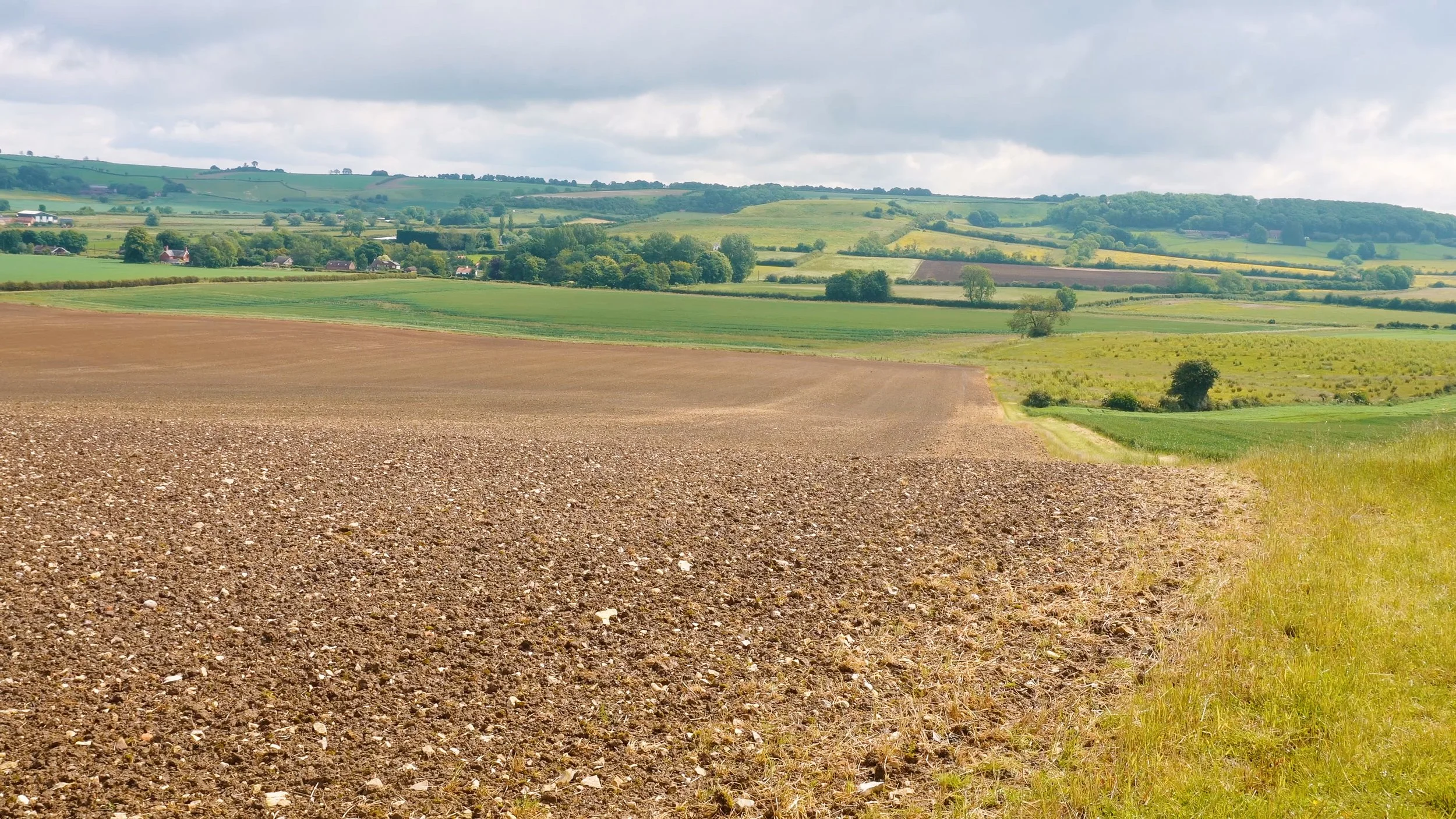
Once you cross over the Humber bridge and head towards the Lincolnshire wolds, which is probably the hilliest section on the second half of this route. But not really. Heading through the Lincolnshire wolds, you will be pedalling through the rolling landscape and that means cycle through the fields. A top tip to remember is if the fields have been ploughed, just follow the parameter of the field to avoid that dreaded clogged up muddy bike. Getting through the Wolds though is fairly quick going, it’s a mixture of grassy trails bridle ways and a few little gravel tracks. And once you get through the wolds, then you will be back to the flattest of land as you head towards Boston and around the coastline along the sea wall to king’s Lynne. This section of country although flat and a pancake is pretty blowy so it can be hard work at times if you are battling the wind.
Check the Humber bridge status here

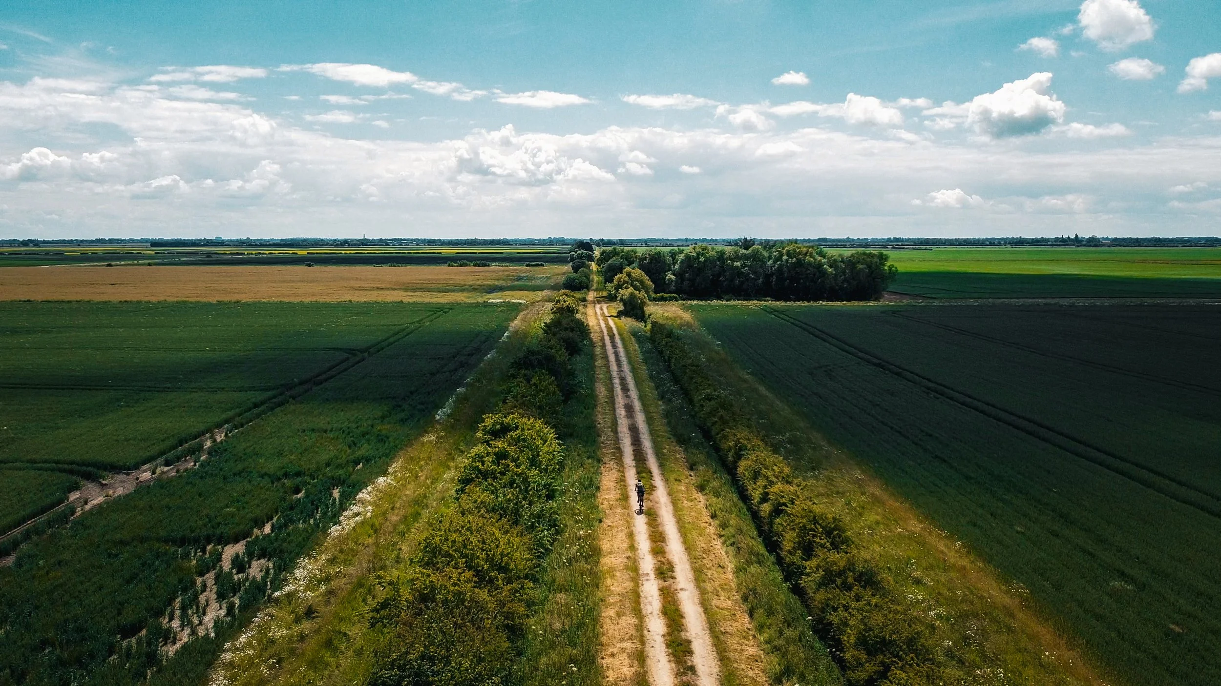
Through the Fields

Views from the seawall as you head around the East Coast to King’s Lynne.
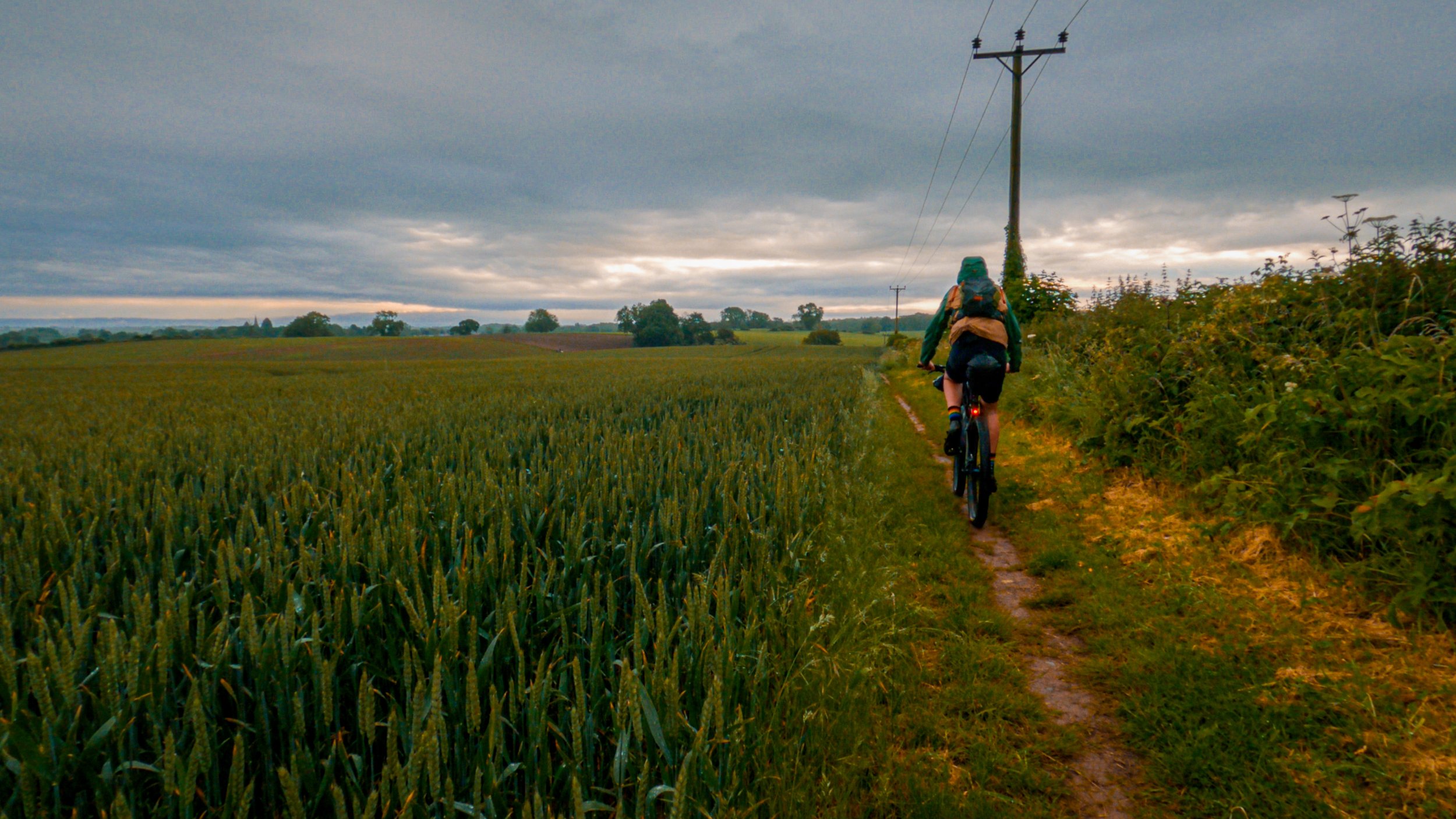
Once you make it around to King’s Lyne you will be heading onto so very well-used trails, the Pedders way and the Ickneilds way. Both of these trails are well signed and really quite easy to follow it a mixture of gravel tracks quiet paves roads and lots of single track. Some of the pedders way was a little over grown in places, but was not bad enough that I was getting stung or had to walk. Apart from one section on the Ickneilds way just past Great Chesterford, that section of the trail is either really nice to ride or over grown from the sides and above. It’s easier enough to detour if you are finding it too over grown by road. By this point you are truly nearly at the end of this epic capital divide with only a few trails left ahead of you. The last 50 miles are mostly all off-road along farm tracks nice a flowy until you get to Stanstead st Margarets where you pick up the River lee Navigation all the way to the heart of London. Enjoy this last stretch of nature before heading your way through the city to Big Ben, where this ride will finish. The ride through London is off course shared with traffic, but I have tried to avoid the busy roads as much as possible the last section is busy, but there is a segregated cycle path all the way to the end.

The Best bike for this adventure is definitely a gravel bike with 45-50mm tyres or a fast rolling Xc bike, but the second half of this ride you will definitely want something fairly easy to pedal into the wind. And on paved surfaces. There are some rougher trails, but the rough stuff is fairly short. If you decide to take on this route, use caution and stay safe out there. Although not a race or anything official, but if you do take on this route and want your time published here let me know, and I will add it.
A single GPX file for the entire route is included for the route, but also I have split GPX Files for this route are split into 7 parts to make it easier for your GPS device. Or check it out on Komoot below. If creating a copy of this route to your own Komoot, bear in mind sometimes Komoot likes to change things.
London - Cardiff